Earth Nullschool
Explore global wind, temperature, and other weather and ocean data on an interactive globe.
What it is
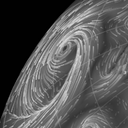
Earth Nullschool is an interactive visualization of global weather and ocean data. You can rotate and zoom the globe, watch animated wind patterns, and switch between layers for temperature, precipitation, ocean conditions, and more.
Why it is selected
It turns large environmental datasets into a global view that is easy to explore. Observing winds around a tropical cyclone, comparing temperatures across regions, or explaining large-scale circulation is more intuitive than reading rows of data.
Who it suits
Weather and ocean enthusiasts, data visualization designers, and students or instructors who need global environmental data for teaching.
Useful for
- Observing wind direction, speed, and temperature at a selected place and altitude
- Explaining global atmospheric or ocean patterns with a rotatable globe
Usage note
In this review, the global map opened without an account, and the menu switched successfully to the temperature layer. The selected state and layer parameters in the URL updated together. Data sources and update intervals for each layer are described on the official About page; model accuracy and update timing were not independently verified. The official site also notes that weather and ocean data are numerical model forecasts and are not guaranteed to be accurate.